
Lend Lease Buildings – Hospitals Construction Planning
Client challenge: the need to win bids and build trust in the construction solution by working interactively to develop exacting, smart, responsive construction site layouts their client can trust. 2D PDF or PPT planning and 3D renders were not convincing.
Our Solution: we provided multiple hospitals sites in our 3D planning system for Lend Lease project managers to work live in 3D during bid development to build trust and confidence in the construction methodology and interface management plan.
Result: 6 hospital bids now supported. Major hospital construction win of $800m (Frankston Hospital).

MTM Projects (NELP): Signals + Layout Planning
Client challenge: any errors in the complex time-critical rail shut-down has enormous cost ramifications. No assumptions or simplifications could be made in the signalling changes and civil works for the CSR relocations, plus safety management.
Our solution: ingest 3D terrestrial lidar (TLS) and develop 3D site planning model. Facilitate parametric rail signal planning process and workshops with client and designers. Provide 3D Planning Tool for construction layouts in added constraints layers.
Result: de-risked rail signalling. ‘Saved millions’ on proposed solutions. Gave client control. De-risked construction methods and site layouts.

KiwiRail – IREX intermodal upgrade planning
Client challenge: the need to work with operational staff on temporary and permanent works planning in a complex road and rail-to-ferry upgrade. The need to enable internal staff and the client to be less responsive and dependent on AECs, including easy review of integrated solutions in the real context.
Our Solution: pieced together datasets across design and survey data to build a 3D Planning Model enabling the client with control and visibility over temporary and permanent works. Extracted multiple engagement pieces and built the client’s profile in the organisation and the community.
Result: ongoing capability development and support to the client across this and other projects with managed services.

City of Yarra – Strategic Planning
Client challenge: meet state rules to update development policies across inner urban Melbourne for greater yield with convincing environment, heritage and neighbourhood responsiveness.
Our solution: build a streaming 3D terrain model and overlay cadastre and 3D buildings. Then convert lot by lot existing, proposed (and interim) built form policies into 3D shapes, including heritage overlays and key views, neighbour and laneway interfaces, height setbacks by level. Provide sanity check on policy-stacking. Support stakeholder alignment and provide key tools in public hearing.
Result: compelling and accurate 3D strategic planning approval process that’s formed a baseline for development assessments.
Keon Park Level Crossing – Upgrade Optioneering
Client challenge: to work quicker to find the optimal solutions for a level crossing upgrade in a constrained environment with major roads, HV overheads, gas underground; multiple disciplines, designers and stakeholders.
Our Solution: starting with lidar terrain model, immediately eliminated multiple options in workshop 1 to save designers’ efforts. Iterated 3D civil solutions collaboratively online and offline with broader team to move to agreed, viable, constructible, quality and affordable project development plan in several weeks – including continuous 3D engagement of executive team.
Result: saved a thousands of hours and much calendar time in moving from ‘anything’ to defined rail-over alignment with great precinct outcomes and viable constructability sequence. Fully engaged wider team through live 3d planning workshops resolving issues live in real-time.

Al Minhad Defence Base – Masterplan
Client challenge: rapid response needed to decant Al Dafra to Al Minhad air base with complex international stakeholder issues, explosive ordnance (EO) zone requirements, compliance and base capacity issues, runway, design and legacy problems and lumbering entrenched overpriced AEC consultants.
Our solution: build a low resolution 3D planning base model. Convert EO policies into 3D templates for click-drag testing; map yield requirements for national and international staff; test aircraft, swept paths, sightlines, hangars, runway design options, servicing options, security policies. Iterate and collaborate across client and international network. Produce iterative 3D masterplans.
Result: rapid development of viable masterplan. Rapid testing of assumptions, resolution on years-old compliance issues, planning of new masterplan designs for runway, layouts, explosive ordnance compliance zones and working estate.

Hay Point Terminal – Construction Planning
Client challenge: rapidly develop a methodology and construction solution for a proposed loading facility and create agreement within the project team.
Our Solution: work from day 1 using 3D planning solution to test, iterate and define construction methods – working from low resolution to higher resolution levels of detail. Include barge placements and movements, and methods for installation of critical elements. Rapidly test multiple construction methods to enable the construction team to have internal resolution conversations on best methods for site conditions.
Result: effective communication of bespoke and standard construction methods. Use in multiple projects. Aligned client team and proved methodology de-risked the project for a proposal with confidence to make margin.

$100m Site Planning, nr Go-Between Bridge
Client challenge: after two years of negotiations and no resolution in sight for the land owner, the client is frustrated and high value land sitting fallow.
Our solution: use our 3D planning technology to facilitate live, reality-based conversations on the visual impacts, opportunities, overshadowing, neighbouring criteria, sightlines, setbacks, car parking access. Facilitated discussion and created collaboration between parties. Iteratively developed 3D massing and yield concept in several weeks in front of Council to gain their buy-in.
Result: client brought to a resolution in under a month some 2 years of frustrating negotiations – which came down to unclear understandings. With our work, $100m of development value is realised and approvals proceed quickly.

3D Urban Planning System – Sunshine Coast Region
Client challenge: develop a planning capability to use across the entire 2,254squkm region to centimetre resolution for any type of planning application, conversation and review.
Our Solution: Convert terra-bytes of spatial 3D data from aerial and ground plane lidar, photogrammetry, ESRI GIS buildings, aerial photography and cadastre – into an easy-use streaming 3D planning system with our 3D planning features and technical support services.
Result: accelerated billions of dollars in development; reduced time and costs of planning processes, including solar access studies, strategic planning, transport masterplanning with access to planning applications. Used daily in development services for urban design and planning impacts across views, shadows, privacy impacts, human-scale view. Used in planning and parks design, public consultation, public space review and executive briefings.

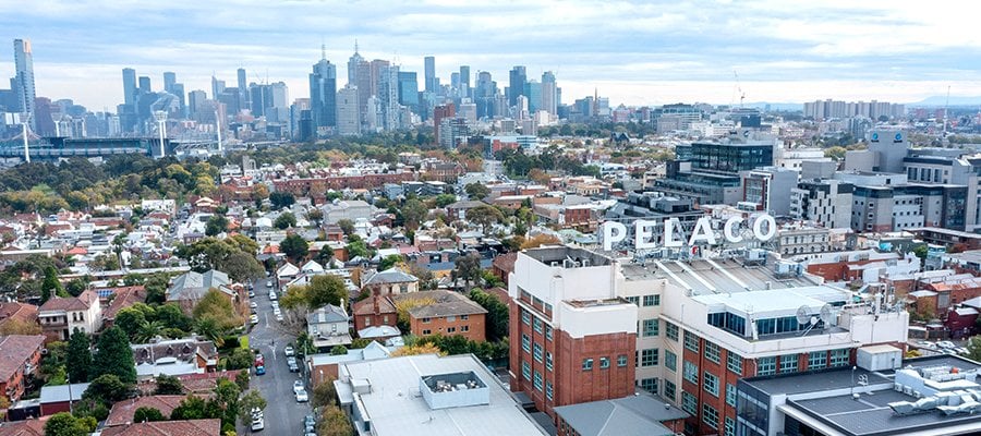
3D Planning System – Melbourne State Development
Client challenge: inefficient planning system of reports taking huge effort to write, not read, with slow approvals of mixed quality – requiring improvement.
Our solution: provide a 10,000 squkm 3D interactive live streaming model to centimetre accuracy across the city-region. Build an import, store, synch and manage workflow with ‘hide existing’ model. Enable and empower 3D Planning, guide and train staff, write policies and upskill the market gradually.
Result: thousands of developments accelerated with issues resolved in ‘months to minutes’ bringing tens of billions of dollars of development forward. Quality and visibility improves with live 3D ministerial planning reviews weekly. massive drop in documentation and costs, improved planning culture and great results for Melbourne’s most liveable city.

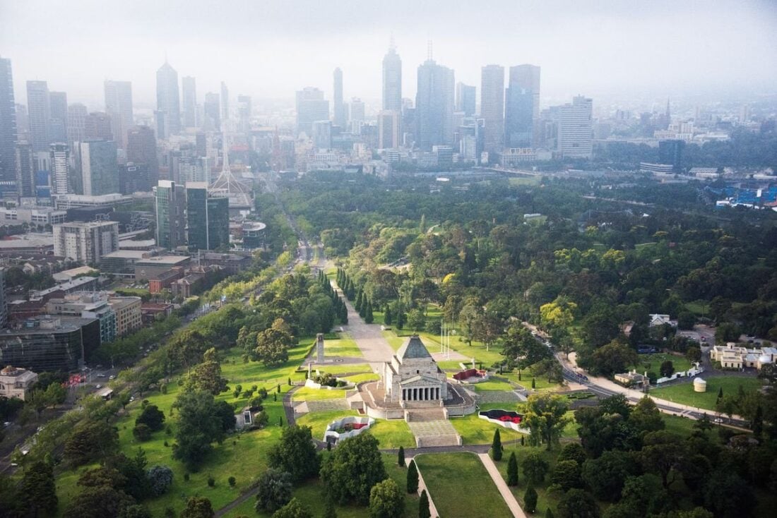
Heritage & Development Planning: MLB Shrine of Remembrance
Client challenge: the Department of Veterans Affairs decreed there is development overcrowding of the important monument and the controls, management and system needs to be improved urgently.
Our Solution: convert complex, hand-written policies in feet and inches into 3D measurable geometric shapes. Overlay these very complex multi-layered shapes into our Melbourne 3D Planning System, with extra feature survey data modelled at the Shrine for millimetre absolute accuracy. Support dozens of iterations of massing codes for negotiated outcomes into a easy to use 3D Plan. Build this system to allow 3D Proposals to be inserted into the context, many kilometres away from the Shrine and capture the intercepting visibility impact irrefutably from any location in the city.
Result: enormous reductions in VCAT trials, as the results were indisputable, saving millions. Enormous savings in the effort to analyse any proposal that in anyway impacted these sightline zones. Massive complexity simplified. Data converted to irrefutable knowledge.
3D Transport Planning System, Victorian Transport x 10 years
Client challenge: inefficient project development with opportunities for better interface management and collaboration across many agencies – saw a global tender released in 2009 which we won and held the sole position for 11 years.
Our solution: develop our 10,000 squkm live streaming 3D Planning model to centimetre accuracy to support transport development projects anywhere. Develop trust with key managers to support private development planning workshops. Provide concept planning and optioneering services to support live 3D Planning. Support plan communications with 3D graphics, video, portals and materials including private cabinet briefings and community engagement.
Result: saving tens of millions on consultants and technical advisors, and enabling the client with strong direct capability we supported >$35bk of projects in development across interfaces, engagement, political responsiveness and an empowered client. Community engagement with political uplift from our media services across thousands of micro-outputs.
Bowden Masterplan Development – ADL
Client challenge: the brief: alleviate fears around higher density outside city centre, demonstrate an awesome living environment; increase property values and create demand; get the project moving; utilise internal skills and know-how; integrate disciplines into a single plan and avoid regulation stacking impacts; demonstrate suitability to residents and viability to developers; plus make decision-makers look brilliant.
Our Solution: converted disparate set of plans, CAD files and documents into a 3D integrated massing masterplan and worked with the team to iterate this into a credible vision to centimetre resolution. Provide tools to demonstrate the incredible urban environment and argue against fire-truck swept paths (wide corners). Bring the plan to life included bespoke music recordings with artists.
Result: won the hearts and minds of locals regarding density, stopped resistance, validated and ensured quality of public space through planning; supported launch events that drove property values and demand significantly; and made the decision makers look awesome and get promotions.

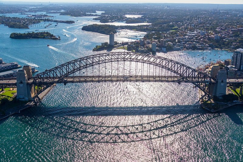
Sydney Harbour Bridge Bus Interchange Planning
Client challenge: disagreement between State on Council on design opportunities, interface integration. A stalemate between architectural fantasy and engineer functionality. No data available.
Our solution: using our 3D Sydney base model, we mediated the conversation between Council and State designers to create their bus interchange visions in an integrated, accurate, live and neutral space. We facilitated the conversation to help resolve interfaces, accesses, gradients, design issues and more. We provided 3D Planning Reports with detailed comparative analyses of the solutions in space.
Result: creating shared understanding and collaboration between previously warring factions, plus creating human scale understanding of each (secret) option including the accessibility for commuters through very complex interchange pathways to utilise this ‘airspace’.
3D Planning System – Launceston City
Client challenge: complex road and traffic proposed changes and a need to promote and encourage quality development in the regional city of Launceston. This included changes to the existing traffic scenarios, traffic signal location changes, concerns of impact of traffic revisions, movements and flow; the experiential quality of key spaces and streets; views from first person, driver, observer on the ground and long views down streets and intersections; the communication of proposed changes to public and government officials; selling redesigned road layouts; a demonstrated master-plan including traffic changes for AM/PM peaks; solar and shadow analyses in complex, narrow urban spaces.
Our Solution: utilise our 3D Planning System to build a demonstrable 3D environment in which we tested, altered and proved the planning solutions.
Result: all challenges resolved, upgrades made and improved client influence. Launceston has run our 3D Planning Model for many years and we have supported them in court cases and complex planning issues.
Flinders Street Station Design Competition
Client challenge: an international design competition for Melbourne most iconic site by the state government requiring meaningful comparative analysis between and across applicants for good decision making.
Our solution: we extracted the 3D base model from our 3D Melbourne and made this available in a standard format, geo-positioned and scaled so that any design agency could utilise the data, and then submit their 3D proposal in a way that ‘snapped to’ this base model, and thus could be reviewed in the 3D context of our 3D Planning Model by design reviewers in private.
Result: an efficient support tool that provided design reviewers the capability to test the veracity of the proposals in a neutral and equanimous format to prove the general viability and connectivity of the solutions proposed.
ANZAC Centenary Event – 3D Planning System
Client challenge: finding solutions across multiple government departments across different nations in sensitive historical contexts can be difficult, and expensive as an event organiser. We were spending hours drawing alternatives which was wasteful when the solutions were not accepted. We need to manage thousands of people in a difficult remote outdoor environment under the scrutiny of the media. There just isn’t any room for mistakes. Planning is everything. Onsite we manage a large team of contractors who need accurate plans to deliver their area of expertise efficiently and accurately. With a range of VVIPs in attendance, and their crews, we are under huge pressure to deliver.
Our Solution: utilise UC 3D Planning System to enable the client to do centimetre accuracy planning in highly sensitive terrain – including inability to use tent pegs or penetrate the soil due to the history. Enable the client with planning tools to test and optioneer event solutions, live with French, Australian, Turkish, New Zealand, British and other nation states involved.
Result: reduced planning costs and increased planning fidelity, shared understanding and delivery across diverse use cases. A perfectly executed event.

South Road Superway – 3D Planning Support
Client challenge: a major new overpass through industrial area with significant impacts and design alternatives with a client team overwhelmed with the admin and answering concerns / ministerials rather than ‘getting to do our actual job’.
Our solution: support the state government team with the ability to test and develop concepts, demonstrate traffic flows, consider alternatives, inspire better urban design, manage consultants, and manage a wide array of stakeholder concerns. Using 3D planning we supported live community engagement session, a large number of internal, private, iterations; internal pitches for design changes, budget extensions and improvements.
Result: the client team went from disempowered, running around doing endless admin answering questions, to having full control with “reducing explanation times by 80% per stakeholder” but also leading the planning process to develop a great result and culture throughout the entire project.


